linkedin facebook
Keystone utilizes UAVs to provide efficient visual inspections and topographic mapping of pipeline...
Read More
Keystone’s photogrammetrists use data from UAV flights to create 3D digital terrain models prior to...
Keystone utilizes UAVs to provide efficient visual inspections and documentation of our client’s...
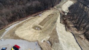
Keystone utilizes UAVs to provide efficient visual inspections and topographic mapping of as-built...